


Road Trip To The Boundary Waters (32)
The Bighorn Mountains (Part 1)

Note: Because of the number of photos, I have had to split this post into two because of size constraints on Substack. Most of the post will appear here. The last bit (part 2) will be released simultaneously.
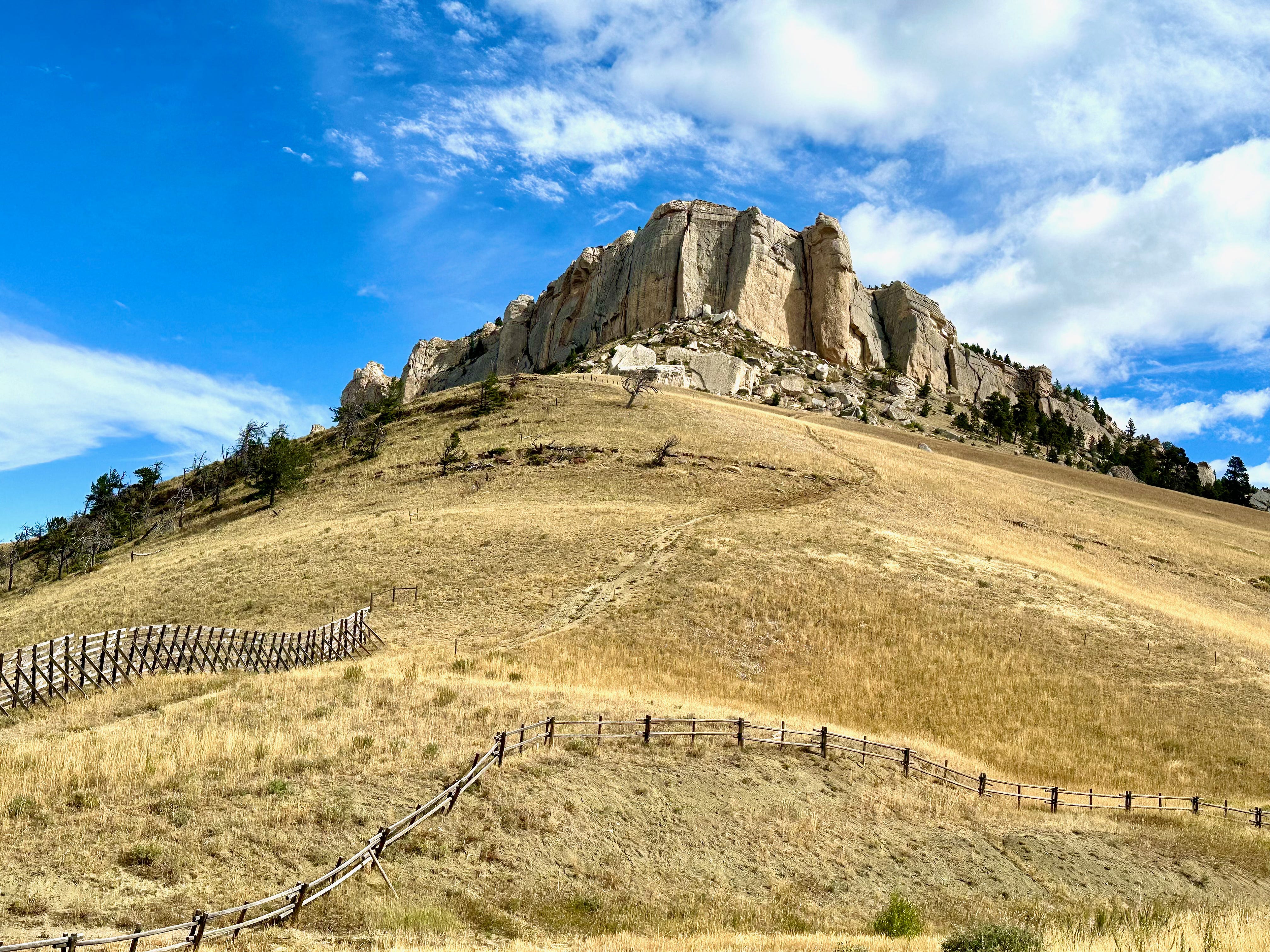
The Bighorn mountains are not heavily trafficked at any time of year. In Mid September visitation is particularly light. The only downside is that the campgrounds close after Labor Day. That leaves dispersed camping off one of the many unpaved forest roads as the only camping option. Which was fine. Guaranteed solitude.
What is exceptional about the high country in the Bighorns, in my experience, are the vast undulating grasslands at the higher elevations.
If you were to climb the Bighorns from their base, either east or west, you would be in for a strenuous slog (more than 8,000 feet elevation gain). But if your trailhead was at the higher elevations off any of the three scenic byways, you would have the rare treat of hour or days spent in a gently sinuous landscape at elevations far above where such landscapes can be found elsewhere, mostly above timberline. I call it alpine pastoral. (Until, that is, a thunderstorm occurs. They pop up with amazing speed in these mountains, as I have learned first hand.)
Long ago I had spent a week in the alpine zone here, but on this visit it was too late in the year. So my hikes were short excursions, mostly to check out the plants and rocks. Animal life was minimal. Most of the birds had flown south, the most visible mammals were chipmunks and red squirrels. I had seen black bears and deer (both mule deer and whitetail deer) on previous visits but not his time. I have never seen a bighorn in the Bighorn Mountains. It is a sad irony that the animal for which the mountains were named was virtually exterminated by 1900. Overhunting was the main culprit but the coup de gras was diseases transmitted by domestic sheep which have long had access to these public lands.
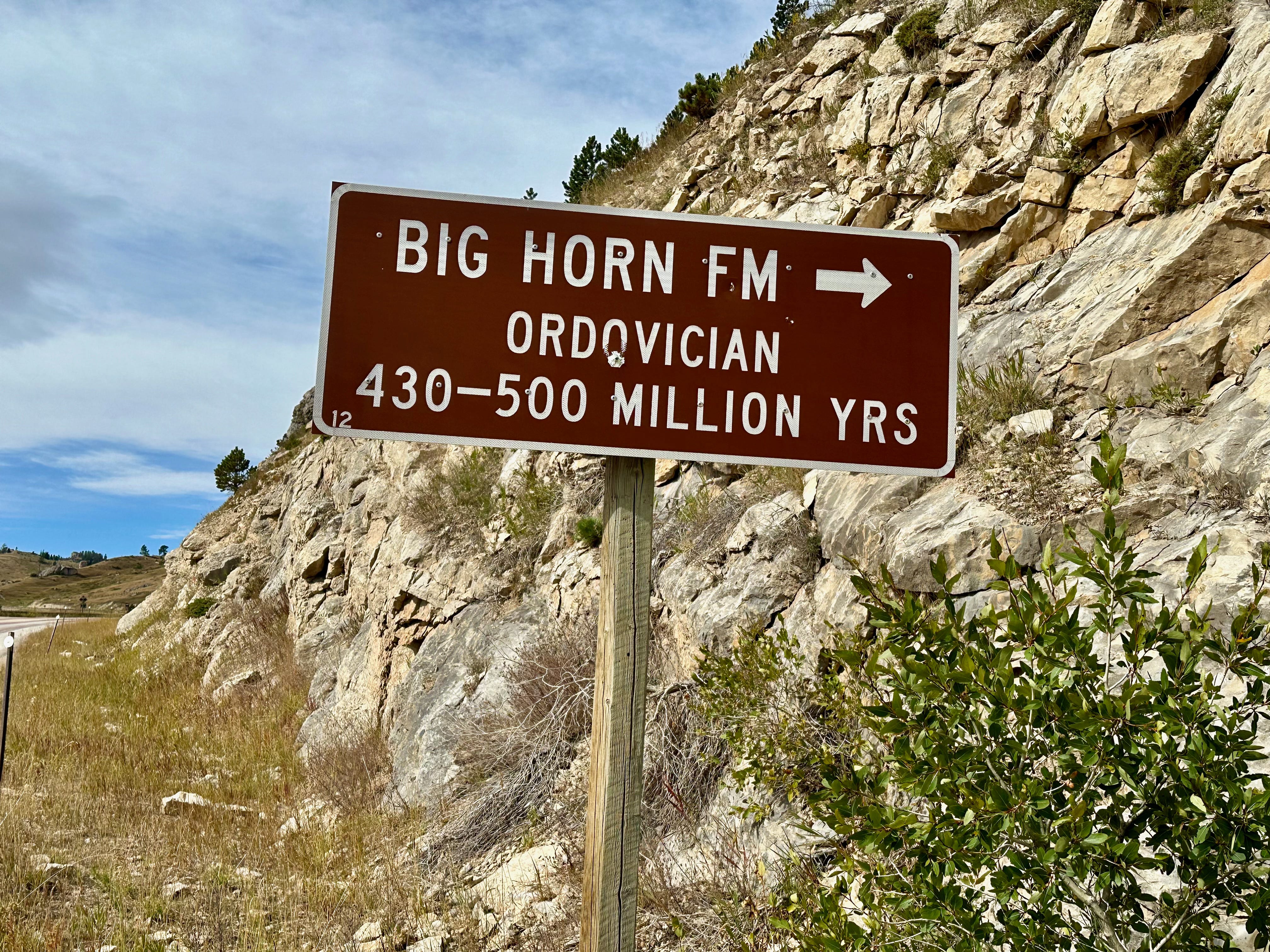
Higher Means Older
As I mentioned in the previous post, all three scenic byways in the Bighorns provide prominent signs indicating significant geological formations and their age*. The rocks get older as you ascend. It may seem counter intuitive that the higher you ascend the older the rocks. Afterall, younger sediments and rocks are deposited on older formations So, if you have, say 10 million years of sediment deposits that can be divided into 10 units, or formations, the oldest formation will be at the bottom of the stack and the youngest at the top. The Grand Canyon is the exemplar of this pattern. The formation on top of the Grand Canyon, called the Kaibab limestone, is 250-300 million years old; the oldest rocks at the base of the canyon, called Vishnu schist, are 1.7-1.8 billion years old. The Vishnu Schist comprises the basement rocks of the Grand Canyon, called the crystalline core, upon which all subsequent formations were sequentially deposited.
The same is true of areas where mountains form, that is, before the mountains form. As mountains grow, the age related layering is absent in the central and highest areas. At the peaks, all that remains are the oldest rocks, the crystalline core. Everything else has been removed by erosion.
When a previously flat plain becomes elevated to any degree, erosion begins at the high points, which are the topmost, hence youngest layers. With increasing elevation of the landscape, the erosion extends to ever older layers. By the time a mountain range matures, many layers have been removed at the highest elevations in the central area, except the oldest crystalline bedrock. The younger formations don’t disappear from the mountains as a whole. You find them on the flanks, decreasing in age toward the mountain base, where erosion is much less powerful.
This visual illustrates the process, as it occurred at Mount Diablo, CA. a place of special significance for me. (Photo) This is a topographic map of the mountains as it exists today. Each line toward the central peak represents a certain amount of elevation increase, say 250 feet. The bold lines represent 1,000 foot elevation intervals.


But pretend this is a basin, rather than a mountain, and the outermost line represents the surface of the land. Everything inside that line represents ever deeper layers. Assume that all layers have equal areas that are coterminous. So the deepest rocks occupy as much space as the rocks on the surface. That is roughly what the area looked like three million years ago, before the formation of of Mount Diablo began..
As the mountain rose, the surface layer was the first to experience erosion, especially in the area that was to become the peak. Then the layer below and so on until Mount Diablo reached its current height—it is still growing—at which point the oldest basement rocks were exposed at the peak. Those old rocks still extend throughout the former area of the basin but are buried, to depths that increase from the peak. The mountain is an inverted basin. This is true of many mountains— including Mount Diablo and the Bighorn Mountains—that consist primarily of sedimentary rocks and their metamorphic derivatives. (Igneous rocks complicate the story).
There is a wonderful hiking trail on Mount Diablo, called The Trail Through Time, that extends from the base of the mountain (a few hundred feet above sea level), to the peak at 3,849 feet. On that trail you ascend through ever older geological features that are described along the way. The same is true when you drive up Highway 16 through the southern Bighorns, as I did on this visit. But the Bighorn rocks are vastly older than those on Mount Diablo. These Bighorn rocks are even older than those of the Grand Canyon. The rocks at the top of the Bighorns are nearly twice as old as the Vishnu Schist (1.7 billion years) at the bottom of the Grand Canyon, which is mind boggling.
On this drive you also experience vestiges of different worlds, from Okavanga-like river deltas, to deserts, to the bottom of tropical oceans. Here are a few highlights, nicely sign-posted by the Wyoming Geologcial Survey.
The Tensleep Formation, at the lower elevations, is equivalent to the Supai Group in the Grand Canyon. It consists of limestones (full of marine fossils)at the base, and sandstone above.
The Madison formation is equivalent to the Redwall Limestone in the Grand Canyon.
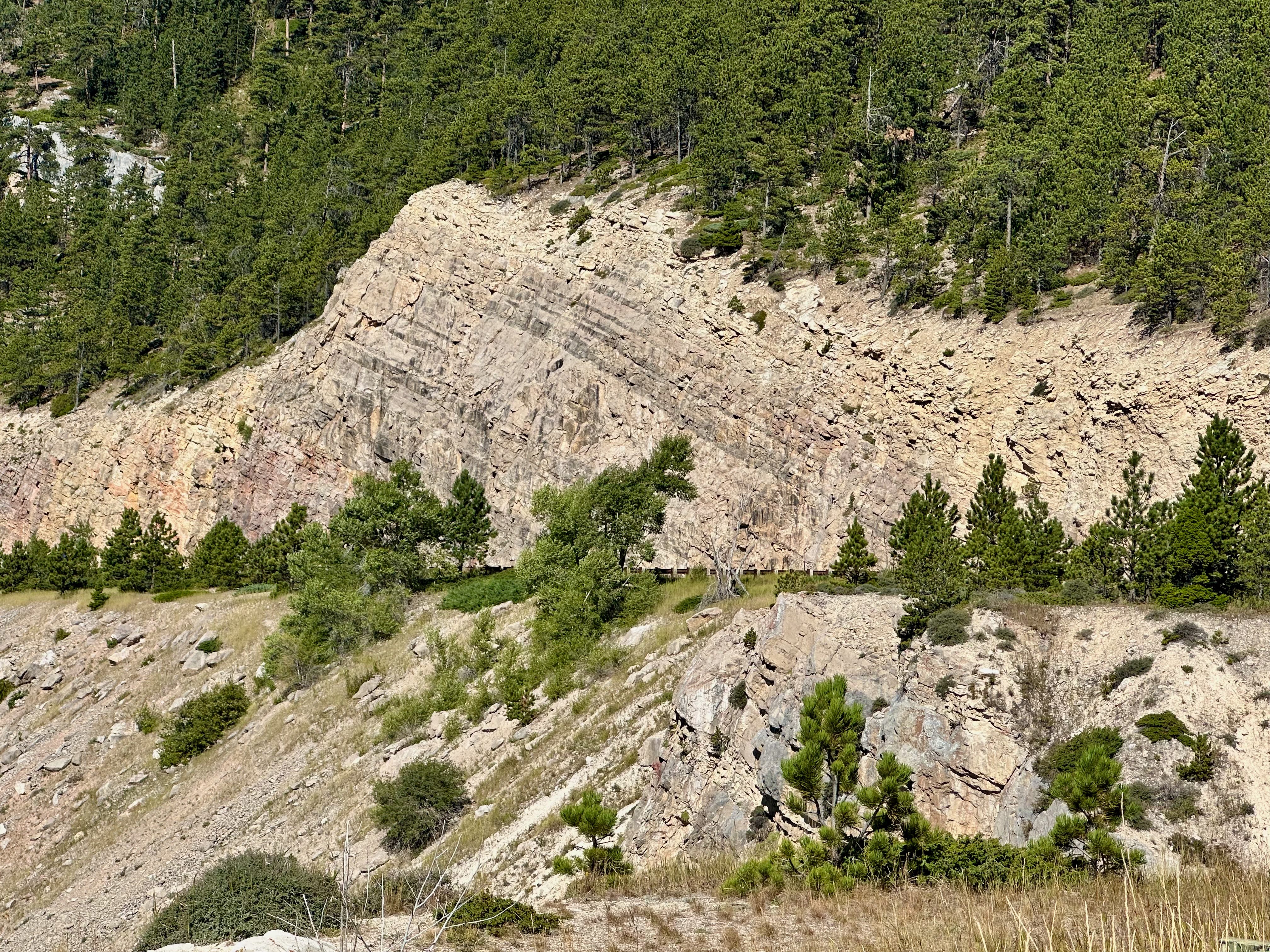
The Bighorn Formation, the name for which derives from their predominance here. (More on which later. This is primarily dolomite, a modified limestone that is more erosion resistant than limestone, and forms cliffs of up to 500 feet. Rocks from this period of time are missing from the Grand Canyon.
Continued Part 2